


Newport Voting District, Page County, Virginia
About
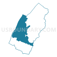
Outline

Summary
| Unique Area Identifier | 682239 |
| Name | Newport Voting District |
| County | Page County |
| State | Virginia |
| Area (square miles) | 88.12 |
| Land Area (square miles) | 87.21 |
| Water Area (square miles) | 0.91 |
| % of Land Area | 98.96 |
| % of Water Area | 1.04 |
| Latitude of the Internal Point | 38.60537170 |
| Longtitude of the Internal Point | -78.56353330 |
Maps


Graphs
Select a template below for downloading or customizing gragh for Newport Voting District, Page County, Virginia


Neighbors
Neighoring Voting District (by Name) Neighboring Voting District on the Map
- Criglersville Voting District, Madison County, VA
- Fort Valley Voting District, Shenandoah County, VA
- Graves Mill Voting District, Madison County, VA
- Marksville Voting District, Page County, VA
- Mt. Jackson Voting District, Shenandoah County, VA
- New Market Voting District, Shenandoah County, VA
- Shenandoah Voting District, Page County, VA
- West Luray Voting District, Page County, VA
Top 10 Neighboring County Subdivision (by Population) Neighboring County Subdivision on the Map
- District 4, Shenandoah County, VA (7,500)
- District 1, Shenandoah County, VA (6,957)
- District 2, Shenandoah County, VA (5,915)
- District 3, Marksville, Page County, VA (5,173)
- District 5, Shenandoah, Page County, VA (5,021)
- District 1, West Luray, Page County, VA (4,906)
- District 4, Newport, Page County, VA (4,425)
- Robertson district, Madison County, VA (4,342)
- Rapidan district, Madison County, VA (3,576)
Top 10 Neighboring Place (by Population) Neighboring Place on the Map
Top 10 Neighboring Unified School District (by Population) Neighboring Unified School District on the Map
- Shenandoah County Public Schools, VA (41,993)
- Page County Public Schools, VA (24,042)
- Madison County Public Schools, VA (13,308)
Top 10 Neighboring State Legislative District Lower Chamber (by Population) Neighboring State Legislative District Lower Chamber on the Map
Top 10 Neighboring State Legislative District Upper Chamber (by Population) Neighboring State Legislative District Upper Chamber on the Map
Top 10 Neighboring 111th Congressional District (by Population) Neighboring 111th Congressional District on the Map
Top 10 Neighboring Census Tract (by Population) Neighboring Census Tract on the Map
- Census Tract 304, Page County, VA (6,321)
- Census Tract 9302, Madison County, VA (5,975)
- Census Tract 305, Page County, VA (5,957)
- Census Tract 303, Page County, VA (5,005)
- Census Tract 408, Shenandoah County, VA (4,721)
- Census Tract 302, Page County, VA (4,177)
- Census Tract 404, Shenandoah County, VA (2,427)
Top 10 Neighboring 5-Digit ZIP Code Tabulation Area (by Population) Neighboring 5-Digit ZIP Code Tabulation Area on the Map
- 22835, VA (11,634)
- 22827, VA (10,388)
- 22851, VA (5,956)
- 22849, VA (5,044)
- 22844, VA (4,528)
- 22652, VA (1,399)
- 22743, VA (204)